Rossendale
| dystrykt niemetropolitalny | |
 Rawtenstall | |
| Państwo | |
|---|---|
| Kraj | |
| Region | |
| Hrabstwo | |
| Siedziba | |
| Powierzchnia |
138 km² |
| Populacja (2016) • liczba ludności |
|
| • gęstość |
506 os./km² |
Położenie na mapie Lancashire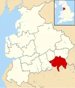 | |
| Strona internetowa | |
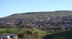
Rossendale – dystrykt w hrabstwie Lancashire w Anglii.
Miasta
Inne miejscowości
Acre, Balladen, Bent Gate, Chatterton, Cloughfold, Cowpe, Crawshawbooth, Edenfield, Goodshaw, Helmshore, Irwell Vale, Newchurch, Sharneyford, Shawforth, Stacksteads, Strongstry, Stubbins, Turn Village, Waterfoot, Weir.
Przypisy
- ↑ Population Estimates for UK, England and Wales, Scotland and Northern Ireland - Office for National Statistics [online], www.ons.gov.uk [dostęp 2017-10-21] (ang.).