Clarke Island
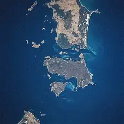 Wyspa Clarke, widoczna pomiędzy Cape Barren (pośrodku) a Tasmanią (lewy dolny róg). Zdjęcie z kosmosu wykonane w styczniu 1997 r. | |
| Państwo | |
|---|---|
| Archipelag | |
| Powierzchnia |
82 km² |
Położenie na mapie Tasmanii 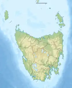 | |
Położenie na mapie Australii  | |
Clarke Island – trzecia co do wielkości wyspa w archipelagu Wysp Furneaux w Cieśninie Bassa. Należy do Australii, jest częścią stanu Tasmania. Leży na południe od wyspy Cape Barren. Zajmuje powierzchnię 82 km²[1].
Ma ona zaledwie sześciu stałych mieszkańców.
Przypisy
- ↑ 1384.6 - Statistics - Tasmania, 2008. Australian Bureau of Statistics. [dostęp 2020-01-12]. (ang.).
Linki zewnętrzne
- Hamish Saunders Memorial Trust, New Zealand and Natural and Cultural Heritage Division, DPIPWE, Hobart: Iungtalanana (Clarke Island), Natural Values Survey 2014. 2014, seria: Nature Conservation Report Series 15/2. ISBN 978-1-74380-007-2.