Hrabstwo Attala
| hrabstwo | |
 | |
| Państwo | |
|---|---|
| Stan | |
| Siedziba | |
| Kod statystyczny |
FIPS 6-4: 28007 |
| Powierzchnia |
1909,08 km²[1] |
| Populacja (2009) • liczba ludności |
|
Położenie na mapie Missisipi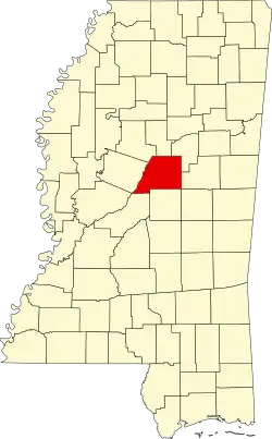 | |
| 33°05′24″N 89°34′48″W/33,090000 -89,580000 | |
| Strona internetowa | |
Hrabstwo Attala (ang. Attala County) – hrabstwo w stanie Missisipi w Stanach Zjednoczonych. Obszar całkowity hrabstwa obejmuje powierzchnię 737,10 mil² (1909,08 km²). Według szacunków United States Census Bureau w roku 2009 miało 19 755 mieszkańców[2].
Hrabstwo powstało w 1833 roku[3].
Miejscowości
| Populacja hrabstwa w poprzednich latach[3] | |
|---|---|
| Rok | Liczba ludności |
| 1980 | 19 718 |
| 1990 | 18 481 |
| 2000 | 19 661 |
| 2005 | 19 552 |
Przypisy
- ↑ US Census Bureau: Population, Housing Units, Area, and Density: 2000. [dostęp 2012-05-17]. [zarchiwizowane z tego adresu (2016-03-09)]. (ang.).
- 1 2 US Census Bureau: Attala County. Quickfacts. [dostęp 2011-03-09]. (ang.).
- 1 2 National Association of Counties: Attala County, MS. [dostęp 2011-03-09]. (ang.).
- ↑ National Association of Counties: Places in Attala County, MS. [dostęp 2011-03-09]. (ang.).
![]()