Hrabstwo Nillumbik
| Państwo | |
|---|---|
| Stan | |
| Burmistrz |
Warwick Leeson |
| Powierzchnia |
435 km² |
| Populacja • liczba ludności |
|
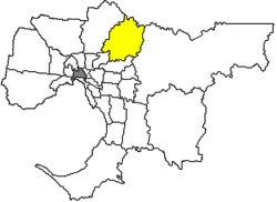 | |
Położenie na mapie Melbourne  | |
Położenie na mapie Australii  | |
Położenie na mapie Wiktorii  | |
| Strona internetowa | |
Hrabstwo Nillumbik – obszar samorządu lokalnego (ang. local government area), położony w północnej części aglomeracji Melbourne. Powstała w 1994 roku z połączenia części hrabstw: Eltham, Diamond Valley i Healesville oraz Whittlesea. Obszar ten zamieszkuje 59 792 osób (dane z 2006).
Dzielnice
- Christmas Hills
- Cottles Bridge
- Diamond Creek
- Eltham
- Eltham North
- Hurstbridge
- Kangaroo Ground
- Nutfield
- Panton Hill
- Plenty
- Research
- Smiths Gully
- Saint Andrews
- North Warrandyte
- Watsons Creek
- Wattle Glen
- Yarrambat
Zobacz też
| Aglomeracja Melbourne |
|
|---|---|
| Pozostałe |
|
