Hrabstwo San Juan (Utah)
| hrabstwo | |
 | |
| Państwo | |
|---|---|
| Stan | |
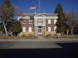
| Siedziba | |
| Kod statystyczny |
FIPS 6-4: 49037 |
| Powierzchnia |
20 547 km²[1] |
| Populacja (2009) • liczba ludności |
|
| • gęstość |
1,8 os./km² |
| Strefa czasowa | |
Położenie na mapie Utah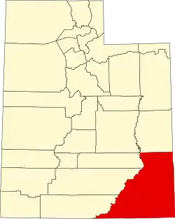 | |
| 37°37′48″N 109°48′36″W/37,630000 -109,810000 | |
| Strona internetowa | |
Hrabstwo San Juan (ang. San Juan County) – hrabstwo w stanie Utah w Stanach Zjednoczonych. Hrabstwu nazwano na cześć apostoła Jana, przez hiszpańskich odkrywców.
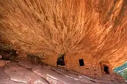
Jest to największe pod względem powierzchni hrabstwo w stanie Utah. Na terenie hrabstwa znajduje się zarówno narodowe jak i stanowe parki chronione. Są to m.in. Park Narodowy Canyonlands (część), Park stanowy Goosenecks, Natural Bridges National Monument.
Na terenie hrabstwa leżą góry La Sal Mountains wchodzące w skład obszaru chronionego Manti-La Sal National Forest[3][4]
Miasta
CDP
Przypisy
- ↑ US Census Bureau: San Juan County. Population, Housing Units, Area, and Density: 2000. [dostęp 2011-01-01]. (ang.).
- ↑ US Census Bureau: San Juan County. Quickfacts. [dostęp 2011-01-01]. (ang.).
- ↑ Feature Detail Report for: La Sal Mountains. Geographic Names Information System, United States Geological Survey. [dostęp 2019-02-08]. (ang.).
- ↑ Welcome to the Manti-La Sal National Forest. U.S. Department of Agriculture. [dostęp 2019-02-08]. (ang.).
| Stolica | |
|---|---|
| Regiony i atrakcje | |
| Hrabstwa | |
| Wybrane miejscowości | |
| Symbole |
![]()