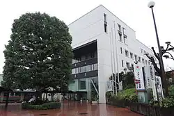
Musashimurayama
| |||||||
 | |||||||
| Państwo | |||||||
|---|---|---|---|---|---|---|---|
| Prefektura | |||||||
| Wyspa | |||||||
| Region | |||||||
| Powierzchnia |
15,32[1] km² | ||||||
| Populacja (2020) • liczba ludności • gęstość |
| ||||||
| Symbole japońskie | |||||||
| Drzewo |
Celtis jessoensis | ||||||
| Kwiat | |||||||
| Ptak | |||||||
Położenie na mapie prefektury Tokio 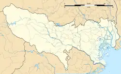 | |||||||
Położenie na mapie Japonii  | |||||||
| Strona internetowa | |||||||

Musashimurayama (jap. 武蔵村山市 Musashimurayama-shi) – miasto w Japonii, na wyspie Honsiu, w prefekturze metropolitarnej Tokio. Ma powierzchnię 15,32 km²[1]. W 2020 r. mieszkały w nim 70 863 osoby, w 29 952 gospodarstwach domowych[2] (w 2010 r. 70 065 osób, w 26 883 gospodarstwach domowych)[3].
3 listopada 1970 roku Musashimurayama-chō zostało przemianowane na Musashimurayama-shi[4].
Przypisy
- 1 2 Geospatial Information Authority of Japan 2021 ↓, s. 28.
- 1 2 Statistics Bureau of Japan 2021 ↓.
- ↑ Statistics Bureau of Japan 2011 ↓, s. 24.
- ↑ 武蔵村山市の歴史. 武蔵村山市公式ホームページ. [dostęp 2011-03-21]. [zarchiwizowane z tego adresu (2011-08-11)]. (jap.).
Bibliografia
- Geospatial Information Authority of Japan: 令和3年 全国都道府県市区町村別面積調 (1月1日時点) (Reiwa 3rd year Area adjustment by prefecture, city, ward, town, and village (As of January 1)). gsi.go.jp, 2021. [dostęp 2021-10-31]. [zarchiwizowane z tego adresu (2021-06-05)]. (jap.).
- Statistics Bureau, Ministry of Internal Affairs and Communications: Preliminary Counts of the Population and Households. [w:] 2020 Population Census [on-line]. e-stat.go.jp Portal Site of Official Statistics of Japan, 2021. [dostęp 2021-10-31]. (ang.).
- 平成22年国勢調査 – 人口速報集計結果 (2010 Census - Population Bulletin Aggregation Results). e-stat.go.jp Portal Site of Official Statistics of Japan, 2011. [dostęp 2021-10-31]. (jap.).
| Okręgi specjalne | |
|---|---|
| Miasta | |
| Powiaty i podprefektury |
![]()
![]()